 you are not logged in


![]()
![]()
![]()
 Global Land Cover Service
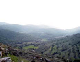
Global Land Cover service Development of an EO system for the production of global land-cover map for the year 2005, using ENVISAT MERIS Fine Resolution (300m) data.
| Project number | n/a | ||
|---|---|---|---|
| Subject(s) | AGRICULTURE , INFORMATION - COMPUTER SCIENCES , MEASUREMENTS AND INSTRUMENTATION , METHTODOLOGY - STATISTICS - DECISION AID , POLICY-WATER POLICY AND WATER MANAGEMENT , RISKS AND CLIMATOLOGY , WATER DEMAND | ||
| Acronym | GLOBCOVER | ||
| Geographical coverage | France, Germany, Netherlands, Belgium | ||
| Budget (in €) | 800000 | ||
| Programme | DUE (Data User Element of the Earth Observation Envelope Programme)- ESA | ||
| Web site | http://dup.esrin.esa.int/projects/summaryp68.asp | ||
| Objectives | The GlobCover initiative develops and demonstrates a service for the generation of a global land cover map for the year 2005/2006. The service is designed in a way that further updates of the land cover map are possible at recurrent cost to run the developed system. GlobCover uses as its main data source the Envisat MERIS fine resolution (300m) mode data acquired between end 2004 and mid 2006. For maximum user benefit the thematic legend is compatible with the UN Land Cover Classification System (LCCS). This new product will update and complement other existing comparable global products, such as the global land cover map at 1 km resolution for the year 2000 (GLC2000) produced by the Joint Research Center (JRC). It is also improves such previous global products, in particular because of the finer spatial resolution (300m). A regionally-tuned classification and the calibration/validation of the classification by a team of regional experts in land cover characteristics will assure the generation of an accurate global land cover map. This approach builds upon the GLC2000 experience as well as the comparison between the GLC2000 map and other similar products (IGBP DISCover, MODIS map). It is also expected that, once a validated GlobCover Land Cover Map exist, it will be easily possible to update such a map over an interval of five years by the reproduction of the processing steps and the use of the initial map as training dataset. The GlobCover is an initiative of ESA that was launched in 2005. It is led by an international network of partners including EEA, FAO, GOFC-GOLD, IGBP, JRC, and UNEP. |
||
| Results | GlobCover at IGARSS, July 2007  GlobCover at the Envisat Symposium, April 2007 GlobCover at EARSeL, September 2006 (abstract) GlobCover at ISPRS, May 2006 GlobCover Flyer  Newsletter January 2008 Newsletter May 2007 Newsletter December 2006 Newsletter July 2006 Newsletter March 2005 Newsletter July 2005 EUM2 - Validation EUM2 - ESA Intro EUM2 - project Status EUM2 - Classification Status EUM2 - ESA Review EUM2 - FAO Experts EUM2 - JRC Experts EUM2 - UNEP Experts EUM2 - EEA Experts EUM2 - UCL Expert EUM2 - Land Cover Expert EUM2 - IGBP Expert - GLP EUM2 - IGBP Expert - iLEAPS EUM2 - GOFC-GOLD Expert EUM2 - ESA Promotion EUM2 - MEDIAS France Promotion and Future EUM2 - Pre-processing Status |
||
| Period | 01/01/2005 | ||
