 you are not logged in


EMWIS on social media
![]()
![]()
![]()
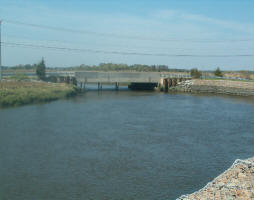
 Snowmelt monitored in the Baltic Sea watershed region in near real time
As spring melt of winter snow is underway in the Baltic Sea watershed region, satellites are monitoring and mapping the snow melting process to help local authorities manage water supplies and predict and prepare for floods. Remote sensing is the only technique capable of providing a comprehensive view over such a large area.
Within the context of ESA’s Polar View programme, funded through the Earthwatch GMES Service Element (GSE), the Finnish Environment Institute (SYKE) is using images from Earth observation satellites to provide snow maps of Finland, Sweden, Estonia, Latvia, Lithuania and parts of Western Russia and Belarus from the beginning of March until the end of May.
| Contact information | n/a |
|---|---|
| News type | Inbrief |
| File link |
http://www.esa.int/esaEO/SEMZ2B7DWZE_environment_0.html |
| Source of information | ESA |
| Keyword(s) | watershed |
| Subject(s) | METHTODOLOGY - STATISTICS - DECISION AID , RISKS AND CLIMATOLOGY |
| Relation | http://www.semide.net/topics/fol573816 |
| Geographical coverage | Finland, Russia, Sweden, Estonia, Latvia, Lithuania, Belarus, Poland |
| News date | 05/04/2007 |
| Working language(s) | ENGLISH |
Login to add a comment
Page last updated:
28/10/2010
