 you are not logged in


![]()
![]()
![]()
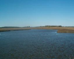
 African water project supported by space
Algeria, Libya and Tunisia have kicked off an ambitious water project called GEO-AQUIFER that will use satellite imagery to support the monitoring and sustainable management of their common, transboundary groundwater resources, bettering the living conditions of their population.
The Aquifer project was developed under ESA's Data User Element (DUE) programme and takes place as part of the TIGER Initiative, aimed at applying EO data to develop a technical, human and institutional capacity to bridge Africa's water information gap using satellite data. Since Aquifer’s initiation in 2004, more than 200 African organisations have become involved in different TIGER projects around the continent.
GEO-AQUIFER provides continuity with the ESA Aquifer project. Its principal aim is to provide information to decision makers and thus to strengthen the integrated water management practice. GEO-AQUIFER will use products and services based on satellite data, such as land-use and land-cover maps, change maps, surface water extent and dynamics, digital terrain models, and derive information on water consumption for irrigation.
Capitalising on the encouraging results of the Aquifer project, GEO-AQUIFER will be an extension and expansion towards increased geographic coverage and user specific fine-tuning of products and services.
| Contact information | n/a |
|---|---|
| News type | Inbrief |
| File link |
http://www.esa.int/esaEO/SEMUNOEVL2F_economy_0.html |
| Source of information | ESA |
| Keyword(s) | transboundary groundwater, sustainable development |
| Subject(s) | MEASUREMENTS AND INSTRUMENTATION , METHTODOLOGY - STATISTICS - DECISION AID , POLICY-WATER POLICY AND WATER MANAGEMENT , WATER DEMAND |
| Relation | http://www.semide.net/topics/fol573816 |
| Geographical coverage | Africa |
| News date | 08/06/2007 |
| Working language(s) | ENGLISH |
