 you are not logged in


![]()
![]()
![]()
 Atlas of Isotope Hydrology – Africa
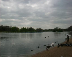
This Atlas of Isotope Hydrology focuses on Africa. Data from nearly 10 500
isotope records gathered from about 80 IAEA projects in 26 African countries
from 1973 to 2007 are included. For each country, a digital elevation map is
provided that shows major water bodies, locations of stations in the IAEA
global network of isotopes in precipitation (GNIP) and the project study
areas. Summary pages for each project include a higher resolution map of the
study area, and data tables and plots for median and mean d18O and d2H,
average annual precipitation and air temperature, tritium values, and
radiocarbon in groundwater.
The Isotope Hydrology Information System (ISOHIS), maintained by the Isotope
Hydrology Section of the IAEA, has been the source of the hydrological and
isotope information used in the compilation of this Atlas of Isotope
Hydrology – Africa. The isotope information presented in the Atlas can be
downloaded through the online application WISER from the internet site:
http://www.iaea.org/water.
The isotopic information presented in this unique Atlas is expected to be a
valuable reference to scientists, practitioners and policy makers engaged in
the field of hydrology.
| Contact information |
K.M. Kulkarni ; L.Araguas - Sales and Promotion Unit, Publishing Section, International Atomic Energy Agency: Wagramer Strasse 5, P.O. Box 100, A-1400 Vienna, Austria
(email: k.m.kulkarni@iaea.org ; l.araguas@iaea.org) Phone: +43-1-2600-22417 ; Fax: +43-1-2600-29302 |
|---|---|
| News type | Inbrief |
| File link |
http://www.iaea.org/books |
| Source of information | IAEA: International Atomic Energy Agency |
| Keyword(s) | groundwater |
| Subject(s) | ANALYSIS AND TESTS , CHARACTERISTICAL PARAMETERS OF WATERS AND SLUDGES , HYDRAULICS - HYDROLOGY , MEASUREMENTS AND INSTRUMENTATION |
| Geographical coverage | Africa |
| News date | 01/02/2008 |
| Working language(s) | ENGLISH |
