 you are not logged in


![]()
![]()
![]()
 The EnMAP hyperspectral satellite to be launched in 2014
The German Aerospace Center (DLR) and the German Research Centre for Geosciences (GFZ) are planning to launch the EnMAP hyperspectral satellite in 2014 to map Earth's surface in over 200 narrow colour channels at the same time.
"The primary goal of EnMAP is to offer accurate, diagnostic information on the state and evolution of terrestrial ecosystems on a timely and frequent basis, and to allow for a detailed analysis of surface parameters with regard to the characterisation of vegetation canopies, rock/soil targets and coastal waters on a global scale," explained EnMAP Project Scientist Prof. Herrmann Kaufmann of GFZ.
"EnMAP is designed to record bio-physical, biochemical and geo-chemical variables to increase our understanding of biospheric/geospheric processes and to ensure the sustainability of our resources."
In 2015, NASA plans to launch the HyspIRI mission, which will acquire images with 210 spectral bands. It will study the processes that indicate volcanic eruption; analyse the nutrients and water status of vegetation; study deforestation; provide early warning of droughts; among others.
Nearly 200 scientists from Europe and North America gathered at ESA's Earth Observation Centre in Frascati, Italy, last week to discuss the current and future hyperspectral/imaging spectroscopy capacity.
The 2010 Hyperspectral Remote Sensing Workshop, co-organised by ESA, DLR, GFZ and ASI, covered topics ranging from products and applications of hyperspectral data use in agriculture, geology, land surface, atmosphere, coastal zones, urban areas, etc. that have been built up and supported by ESA's CHRIS Proba mission over the past eight years.
| Contact information | n/a |
|---|---|
| News type | Inbrief |
| File link |
http://www.esa.int/SPECIALS/Proba_web_site/SEMFVBIK97G_0.html |
| Source of information | ESA |
| Keyword(s) | vegetation canopies, coastal waters, early warning of droughts |
| Subject(s) | INFORMATION - COMPUTER SCIENCES , MEASUREMENTS AND INSTRUMENTATION , METHTODOLOGY - STATISTICS - DECISION AID , RISKS AND CLIMATOLOGY , TOOL TERMS , WATER DEMAND |
| Relation | http://www.semide.net/topics/fol573816 |
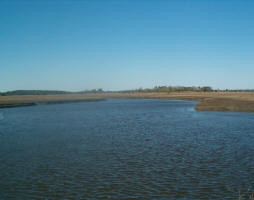
| Geographical coverage | Germany, Europe |
| News date | 31/03/2010 |
| Working language(s) | ENGLISH |
