 you are not logged in


![]()
![]()
![]()
 UNEP Releases Africa Water Atlas
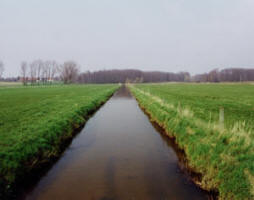
This Atlas is a visual account of Africa's endowment and use of water resources, revealed through 224 maps and 104 satellite images as well as some 500 graphics and hundreds of compelling photos.
However the Atlas is more than a collection of static maps and images accompanied by informative facts and figures: its visual elements vividly illustrate a succinct narrative describing and analyzing Africa's water issues and exemplifying them through the judicious use of case studies.
It gathers information about water in Africa and its role in the economy and development, health, food security, transboundary cooperation, capacity building and environmental change into one comprehensive and accessible volume. UNEP undertook the production of this Atlas at the request of the African Ministers' Council on Water (AMCOW) and in cooperation with the African Union, European Union, US Department of State, United States Geological Survey and other collaborators.
The Atlas along with its summary for Decision Makers is available for free download at http://na.unep.net/atlas/africaWater/book.php
All the materials in the Atlas are non-copyrighted and available for free use as long as the Atlas is acknowledged as the source.
| Contact information |
Arshia Chander, UNEP GRID Sioux falls
(email: geas@unep.org ; achander@usgs.gov) Phone: +1 605-594-6006 |
|---|---|
| News type | Inbrief |
| File link |
http://na.unep.net/atlas/africaWater/book.php |
| File link local |
|
| Source of information | UNEP |
| Keyword(s) | water resources |
| Subject(s) | HYDRAULICS - HYDROLOGY , INFORMATION - COMPUTER SCIENCES , METHTODOLOGY - STATISTICS - DECISION AID , TOOL TERMS |
| Geographical coverage | n/a |
| News date | 09/12/2010 |
| Working language(s) | ENGLISH |
