 you are not logged in

![]()
![]()
![]()
 First Indo-French Satellite for the Study of Water Cycles in the Tropics
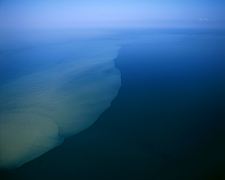
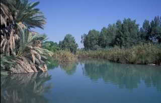
Megha-Tropiques, the first Indo-French climate satellite, has been launched on 12 October 2011 from the Satish Dhawan Space Centre, Sriharikota. This is the first time that a satellite is used to help study atmospheric water cycles and energy fluxes in the inter-tropical region. Megha-Tropiques thus aims to improve our knowledge in tropical climatology.
A collaboration between the two national spatial agencies, the Centre National d’Études Spatiales (National Centre for Space Studies-CNES) and Indian Space Research Organization (ISRO), Megha-Tropiques emerged from a Memorandum of Understanding for cooperation on this mission, which was signed in November 2004. This constitutes yet another major landmark in a rich and longstanding spatial collaboration between India and France, which dates back to the 1960s.
‘Megha’ means ‘cloud’ in Sanskrit and ‘Tropiques’ refers to the Tropics in French, thus bestowing a poetic name for a very unique spatial mission. The mission’s scope is extremely pertinent given recent events in the tropical zone, such as hurricanes or droughts, and will provide new and high quality data for the international scientific community. The satellite, assembled in Bangalore and weighing around one ton, will be put into orbit by a PSLV. Megha-Tropiques uses an Indian platform (IRS) and its payload consists of three instruments: MADRAS, a microwave imager that will study precipitation and cloud properties; SAPHIR, a microwave sounding instrument for atmospheric water vapour and SCARAB, a radiometer that will measure outgoing radiative fluxes at the top of the atmosphere. Once in orbit, the satellite will be monitored by ISRO.
The microwave instruments, which can soak in the clouds, will be able to provide complementary measurements with a good temporal repetitiveness. The orbit of the platform will be in a low inclination on the equatorial plane and the altitude of the orbit will be high enough to allow a wide swathe for the instruments.
Prospects:
A cooperation agreement was signed on 8 September 2011 in Washington between CNES and the National Aeronautics and Space Administration (NASA) to integrate data from Megha-Tropiques with those of the Global Precipitation Measurement mission (GPM). GPM will be an international network of satellites dedicated to the global study of precipitation that will eventually cover most of the planet. A similar agreement will be signed soon between ISRO and NASA. Megha-Tropiques is the first mission of its kind to observe the Earth and will cover countries other than India and France. This collaboration will increase the scientific impact and fame of the Megha-Tropiques, and is, in a way the first satellite of the entire GPM constellation.
For further information on the satellite, please click here.
--
Plus d'info:
- Launch of Megha-Tropiques: First Indo-French Satellite for the Study of Water Cycles in the Tropics
- Tropical Climate Satellite Soars for India, France
- ISRO Launches Joint French-Indian Satellite To Study Tropical Monsoons
- France and Indian weather satellite to observe global warming
- LTU Takes Part in French-Indian Satellite Project
- Indian satellite to study tropical water cycle
| Contact information | n/a |
|---|---|
| News type | Inbrief |
| File link |
http://ambafrance-in.org/IMG/pdf_pslv-c18-brochure.pdf |
| File link local |
|
| Source of information | IRC |
| Subject(s) | HYDRAULICS - HYDROLOGY , INFORMATION - COMPUTER SCIENCES , MEASUREMENTS AND INSTRUMENTATION , METHTODOLOGY - STATISTICS - DECISION AID |
| Relation | http://www.cnes.fr/web/CNES-fr/6919-cnes-tout-sur-l-espace.php |
| Geographical coverage | India, France |
| News date | 24/10/2011 |
| Working language(s) | FRENCH |
