 you are not logged in

![]()
![]()
![]()
 Harnessing Science and Technology toward Improved Water Management
In partnership with NASA and the World Bank, OMEP recently helped launch two regional projects which apply cutting-edge NASA technology to inform key water resources management and policy issues in the region.
The two complementary programs rely on remote sensing to gather water-related data: the Land Data Assimilation System (LDAS) and the Water Information Systems Platform (WISP). The programs are a collaborative effort among USAID, the World Bank, NASA, the International Center for Biosaline Agriculture (ICBA), the Arab Water Center and five countries in the region. The programs are based on the principle that regional scale water resources data can be collected faster and more cost-effectively from space than from on-the-ground gauges and monitoring systems.
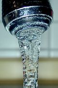
Well monitoring, resource availability, and on-farm water application data is not readily available in the region. When data does exist, there are barriers to data sharing between different ministries and agencies within a particular country, as well as across borders. As a result, we are missing a tremendous opportunity to inform ground water-related decisions with real, verifiable, scalable data.
LDAS, a three-year, $2-milllion project, implemented by ICBA, is scheduled to end this December. The project uses NASA satellite data and models to develop a dataset that will help researchers and decision makers better understand the availability, location, and use of water resources at a regional scale. The data will also be analyzed to help create a regional model that forecasts climate change impacts.
WISP, launched last October, will provide grants and technical expertise to the remote-sensing agencies of Morocco, Tunisia, Egypt, Jordan and Lebanon. Region-wide, this investment will leverage satellite-based sensing technologies to inform water resource decision-making, including irrigation management, and drought and flood forecasting.
The resulting, national and regional scale data will be widely available online, with higher resolution data available to in-country decision makers. Effective water management decisions require first and foremost reliable, available, scalable data. The overarching goal of these projects is to improve the data available to researchers and decision-makers, and help foster a culture of data-informed water resources policy and management.
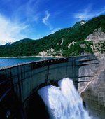
Home to 10% of the world’s people, but just 1% of the world’s water, programs such as WISP and LDAS can play an important role in making the most of increasingly scarce regional water resources. These programs demonstrate the importance of science and technology in water resources decision-making. Ideally, data-driven decision-making helps us make optimal use of water resources, and mitigate against water related conflict.
The benefits of remote sensing were highlighted by Mr. Neji Fekih, Director General, North African Center for Remote Sensing (CRTEAN) in Tunisia, who said “[it] has become difficult if not impossible to monitor and track environmental phenomena by conventional methods. Remote sensing techniques are an important resource for planning and protection of our natural resources."
| Contact information | n/a |
|---|---|
| News type | Inbrief |
| File link |
http://www.usaid.gov/omep/articles/article_1538.html |
| Source of information | USAID |
| Subject(s) | AGRICULTURE , HYDRAULICS - HYDROLOGY , INFORMATION - COMPUTER SCIENCES , INFRASTRUCTURES , MEASUREMENTS AND INSTRUMENTATION , METHTODOLOGY - STATISTICS - DECISION AID , NATURAL MEDIUM , POLICY-WATER POLICY AND WATER MANAGEMENT , RISKS AND CLIMATOLOGY , WATER DEMAND , WATER QUALITY |
| Relation | http://secure.socopa.com.tn/en/en/economy/9892-nasa-remote-sensing-models-for-better-management-of-water-resources.html |
| Geographical coverage | Morocco, Tunisia, Egypt, Jordan,Lebanon, |
| News date | 19/03/2012 |
| Working language(s) | ENGLISH |
