 Egypt: Ancient river could be revived for farming
A 5,000-year-old river could be resurrected to bring sustainable agriculture to one of the planet's rainiest yet driest deserts, according to a study, which proposes an ambitious engineering scheme for Egypt that the country's government is now reviewing.
|
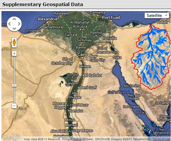
The desert of the Sinai Peninsula receives the most rainfall of any part of Egypt — around 304 millimetres annually — but most of it is of no benefit to agriculture, instead flowing out into the Mediterranean Sea in flash floods. The river originally led to three ancient lakes in a depression west of Gebel Halal, a mountain in northern Sinai. |
The proposed project — which the Egyptian government is now assessing — would involve "a follow-up study to estimate the possibility and the outcomes of surface runoff redirection through a canal and evaluate the consequences of this flow deviation", AbuBakr tellsSciDev.Net.
The plan is to create a high-resolution computer model — supplemented with field measurements and geophysical explorations — to construct a detailed hydrological simulation of the diversion to assess its impacts on the environment, local ecosystems and any archaeological sites in the areas around the ancient lakes.
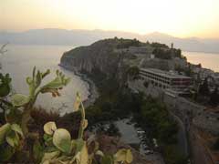
In addition to the potential to support agriculture, redirecting the river flow in this region would help to mitigate the risk of flooding in El-Arish City, the capital of the North Sinai governorate, which lies on the coast at the end of the Wadi El-Arish.
--
Bringing water to the Sinai?
http://phys.org/news/2013-06-sinai.html
| Contact information |
Dr. Farouk El-Baz, Director: Center for Remote Sensing, Boston University 725 Commonwealth Avenue Boston, MA 02215-1401 // Mostafa AbuBakr, Center for Remote Sensing, Boston University, 725 Commonwealth Avenue, Boston, MA 02155, USA
(email: farouk@crsa.bu.edu ; mostafa@bu.edu) Phone: +1 (617) 353-9709 Direct line: +1 (617) 353-5081 Fax: +1 (617) 353-3200 // + 1 617 353 5981; fax: + 1 617 353 2000. |
|---|---|
| News type | Inbrief |
| File link |
http://www.sciencedirect.com/science/article/pii/S0169555X13001992 |
| Source of information | SciDev.Net |
| Keyword(s) | sustainable agriculture, rainwater, satellite data, radar, floods, flash floods, runoff, irrigation, groundwater salinity, desert, aquifer, topography, geology |
| Subject(s) | AGRICULTURE , HYDRAULICS - HYDROLOGY , INFORMATION - COMPUTER SCIENCES , INFRASTRUCTURES , MEASUREMENTS AND INSTRUMENTATION , METHTODOLOGY - STATISTICS - DECISION AID , NATURAL MEDIUM , RISKS AND CLIMATOLOGY , TOOL TERMS , WATER DEMAND |
| Relation | http://www.semide.net/countries/fol749974/country769281 |
| Geographical coverage | Egypt, |
| News date | 18/07/2013 |
| Working language(s) | ENGLISH |
 you are not logged in


