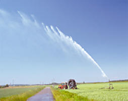
 IDRC CRDI/M. YAHIA Parts of the Nile Delta will be vulnerable to rising sea levels. Sea level rise and land loss in the Nile Delta
IDRC-funded researchers have identified coastal areas in the Nile Delta that may be vulnerable to sea level rise using Geographical Information Systems (GIS). Results indicate that significant land loss may occur in that region by 2100. Using the most recent predictions of sea level rise, total coastal land lost could be between 22 to 49%. This land loss may occur if nothing is done to adapt to climate change.
Where would the damage occur?
The researchers found that damage from rising sea levels would depend on how the land is being used. Most likely, farmland would experience the greatest impacts followed by coastal wetlands, vacant land, and built-up areas. Some constructed features (such as roads) can decrease land’s vulnerability to sea level rise, even though protecting coastlines may not have been their original purpose.
The researchers also noted that even in the absence of sea level rise, almost 16% of the total coastal land in the Nile Delta may be lost due to subsidence.
In their paper, Vulnerability of the Nile Delta coastal areas to inundation by sea level rise, M.A. Hassaan and Mohammad Abdrabo used GIS to identify areas and land use/cover that may be susceptible to sea level rise by 2100. This paper is a result of a project supported by IDRC’s Climate Change and Water program, Establishing the Alexandria Research Centre for Adaptation to Climate Change (ARCA).
| Contact information | n/a |
|---|---|
| News type | Inbrief |
| File link |
http://www.idrc.ca/EN/Results/Pages/ResultsDetails.aspx?ResultID=166 |
| Source of information | IDRC |
| Subject(s) | METHTODOLOGY - STATISTICS - DECISION AID , NATURAL MEDIUM , PREVENTION AND NUISANCES POLLUTION , RISKS AND CLIMATOLOGY |
| Relation | http://hdl.handle.net/10625/50691 |
| Geographical coverage | Egypt, |
| News date | 16/06/2014 |
| Working language(s) | ENGLISH |
 you are not logged in


