 you are not logged in


EMWIS on social media
![]()
![]()
![]()
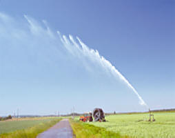
 Using real-time satellite data to track water productivity in agriculture
20 April 2017, Rome-Measuring how efficiently water is used in agriculture, particularly in water-scarce countries, is going high-tech with the help of a new tool developed by FAO.
The WaPOR open-access database has gone live, tapping satellite data to help farmers achieve more reliable agricultural yields and allowing for the optimization of irrigation systems.
WaPOR was presented this week during a high-level partners meeting for FAO's Coping with water scarcity in agriculture: a global framework for action in a changing climate. It allows for fine-grained analysis of water utilised through farming systems, generating empirical evidence about how it can be most productively used.
| Contact information | n/a |
|---|---|
| News type | Inbrief |
| File link |
http://news.trust.org/item/20170420090758-1wt83/ |
| Source of information | trust |
| Subject(s) | AGRICULTURE |
| Geographical coverage | Italy, |
| News date | 20/04/2017 |
| Working language(s) | ENGLISH |
Page last updated:
20/04/2017
